El-Arish Travel Guide
The Governorate of Northern Sinai occupies the northern section of the peninsula with the Mediterranean Sea in the north, Israel to the east, the Suez Canal in the west, and the governorate of South Sinai, with cities like Sharm El Sheikh, Dahab, and Nuweiba in the south.
The Governorate of North Sinai has a surface area of around 27564 square kilometers and a population of around 400,000 inhabitants with most of them residing by the shores of the Mediterranean Sea, except for some nomadic Bedouins who live in the desert located in the middle of Sinai.
The environmental characteristics of North Sinai can be divided into two categories; the coastal area of the Mediterranean Sea in the Northern Plains covered with sand dunes, and the desert environment located inside the Sinai Peninsula with a large number of mountains like 776 -meter-high Maghara Mountain and 881-meter-high Halal Mountain.
The City of El Arish

El Arish is the largest city in the Sinai Peninsula and the administrative capital of the governorate of North Sinai. El Arish is famous for its long beaches situated on the Mediterranean Sea and its numerous palm trees all over the city.
El Arish is situated in a wonderful location along the Mediterranean Coast of Sinai and the city, the largest in Sinai, has a population of around one million inhabitants today.
During different periods of time, the Egyptians have used El Arish as an outpost in Sinai, especially during the Roman and Ptolemaic eras. Later, the city was fortified during the Middle Ages and then during the Ottoman era.
However, only small traces and ruins remained of the historical structures constructed in and around El Arish in different periods of time. This is mainly due to the lack of renewal and restoration projects in Northern Sinai
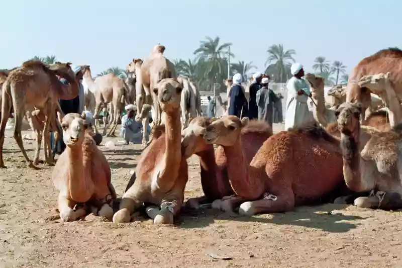
A Bedouin market is held every Thursday and the nomads from all over Northern Sinai gather to exchange products, handicrafts, herbs, and many other goods.
In fact, El Arish is considered to be the best place to find the famous handcrafts of the Bedouins of Sinai. Moreover, the city hosts the only museum dedicated to the culture of the nomads and Bedouins of Sinai; the Sinai Heritage Museum.
There are many other interesting sites in and around the city of El Arish, including the Zaranik Protected Area, situated 30 kilometers west of the city of El Arish, and the Baradwil Lagoon, which is considered to be an important transit point for migratory birds.
There are a large number of bird species that pass by Zaranik during their immigration journey. In fact, there are more than 270 species that can be watched in the area.
The History of El Arish
El Arish is the largest urban center in Sinai and actually the biggest desert city in Egypt overall. During different periods of time, El Arish hosted one of the most important ports in Egypt where commercial caravans used to pass.
El Arish had vital military importance as well. Due to its location along the Horus military route, which was used by the pharaohs during their campaigns to Palestine and Asia Minor. Its location gave El Arish significant strategic importance.
During the Middle Ages, El Arish remained as important as it has always been, especially with the Arabs conquering Egypt. It was used as a transit point by Amr Ibn El Aas when he was on his way to take control of Egypt.
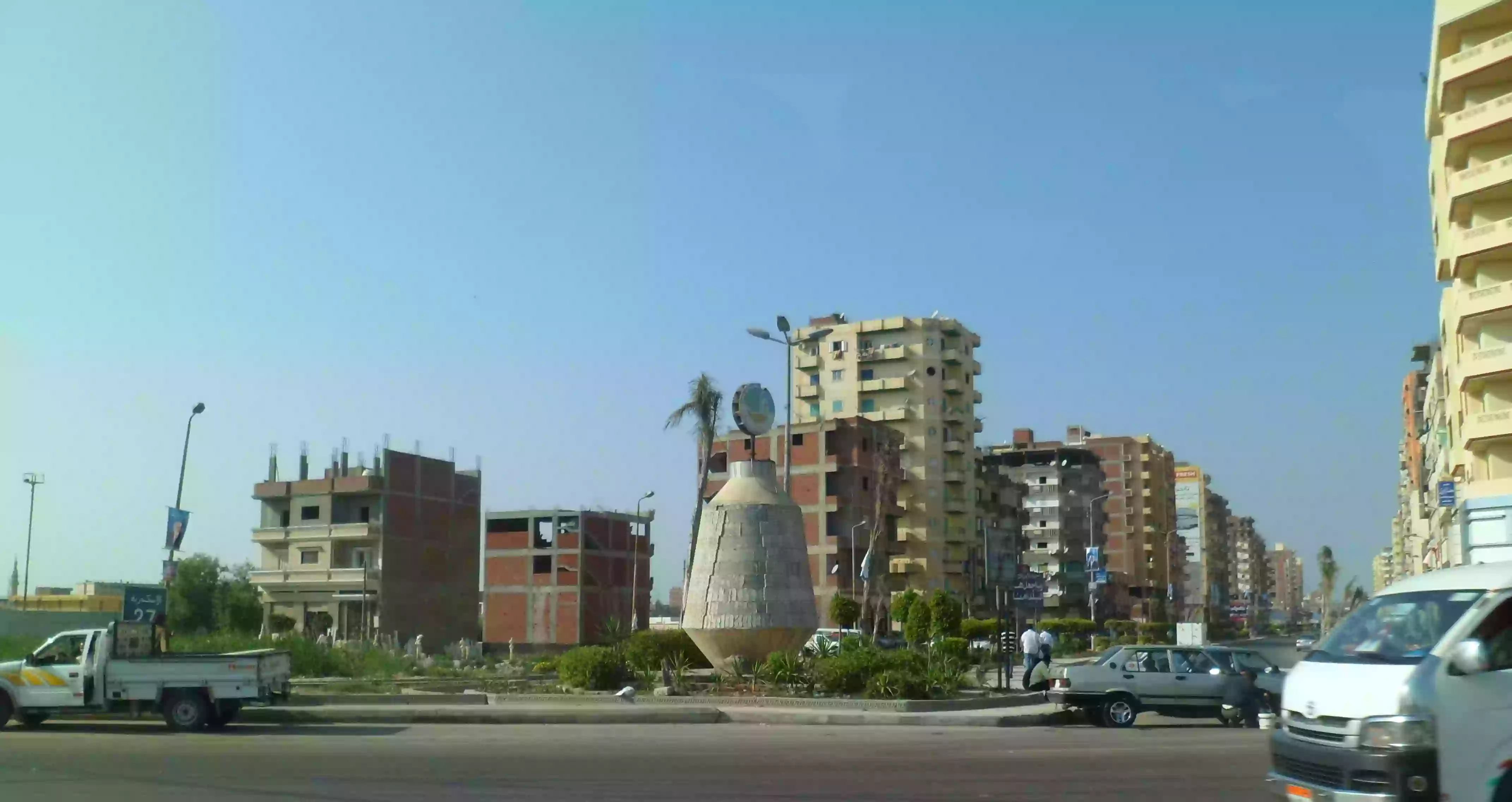
Today, El Arish has become a major center for cultural, social, and commercial activities in Northern Sinai. There are also many new neighborhoods that were established in the city like El Rayessa, El Salaam Wa El Giesh, and El Masaied.
El Arish has a civil airport that serves Egyptians and tourists who visit Northern Sinai. It also has a port situated on the Mediterranean Sea and a wonderful zoo with a wide variety of animals and colorful species.
The Beaches of El Arish
Nicknamed the beaches of the palm trees, the beaches of El Arish are extended over an area of around 10 kilometers from the east to the west. The city of El Arish and the whole region of North Sinai offer magnificent beaches and resorts for tourists who love spending their vacations by the seaside.
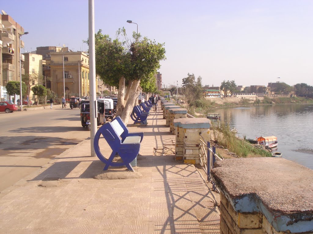
El Arish has a wonderful Kornish Street, the same as many other coastal cities in Egypt, where there are a number of tourist facilities, hotels, chalets, some restaurants, and cafes.
All means of transportation like buses, many buses, taxis, and privately rented cars can be hired from Kornish Street in Arish and travel anywhere around the city and many other locations around Sinai as well.
The Fortress of El Arish
The Fortress of El Arish is the only surviving monument in the region. It was constructed in the ruling period of the Mamluks in Egypt. The fortress used to also have a freshwater well, a large garden, and shelters for soldiers.
The fortress has witnessed many important historical events like the treaty that was signed between the French and the Ottomans in the 19th century. Moreover, with some excavation efforts, the Fortress of El Arish may turn out to have many more treasures to reveal.
The Protected Aresa of Zaranik and Bardawil Lake
The Protected Area of Zaranik is situated 30 kilometers west of the center of the city of El Arish. This protected area represents the major key routes of the immigration of birds around the world and it links the three continents of Africa, Asia, and Europe.
Birds use Zaranik as a bridge to pass between these continents especially during the seasons of autumn and spring for many reasons and this is why Zaranik is a marvelous location for bird watching.
The birds immigrate from Eastern Europe, North West of Asia, Russia, and Turkey on their way to Middle and southeast Africa to escape the cold weather and seek new sources of food that are available in the Protected Area of Zaranik.
Some of these birds reside in some of the Egyptian lakes like Baradwil Lake, situated near the Protected Area of Zaranik, and other lakes along the East Bank of the Suez Gulf.
Two hundred and forty-four species of birds have been officially recorded in the Protected Area of Zaranik. These species include swans, ducks, herons, cattle egrets, stork Mirza chicken, falcons, quail, buzzards, and sandpipers, gulls and terns, lunar, crow, hoopoe, and rubella.
The geological characteristics of the Protected Area of Zaranik are also distinctive because the area belongs to the wetlands in the basin of the Mediterranean Sea and the Protected Area is situated in the Eastern section of Bardawil Lake.
The Protected Area of Zaranik includes many sections like the Zaranik Lake, the desert islands, and the sand bulkhead that separates this area from the Mediterranean Sea.
There are around 270 species of birds that visit the Zaranik Protected Area every year. These include herons, wading birds, gulls, hooks, quail, pasture, and many other kinds of birds.
The Ancient City of Pelusium
West of the Protected Area of Zaranik is the ruins of the ancient city of Pelusium. These remains are scattered over a large area of land that was just recently excavated and is being studied.
Pelusium was established as early as the Pharaonic civilization and was an important transit point for caravans going from Egypt to Syria and Palestine. The city of Pelusium remained as important even during the Ptolemaic and Roman periods afterward. The City of Pelusium only witnessed its decline during the 7th century A.D.
The Coastal Bushes of Northern Sinai
The area of the Coastal Bushes that extend from El Arish to the city of Rafah, on the Egyptian Eastern borders was declared as a natural protected area as it contains a large number of important species of trees and plants. As such, it is a key natural resource of food for many wild animals and birds.
However, this area needs to be more protected and preserved during the coming period in order to control the grazing of sheep as they contribute to the disappearance of certain plants in this region.